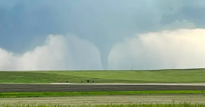
A cluster of powerful tornadoes tore through some parts of North Dakota on Friday night, and communities like Spiritwood, Eckelson, Valley City, and Jamestown were left in a state of alert. Forecasts on severe weather and tornado warnings, and watches have been issued in more than a dozen counties as the weather is set to be unpleasant in the area. National Weather Service (NWS) reported that there had been at least one huge twister touched down around Spiritwood and Eckelson, and encouraged people that more could be developing during the night.
People and rescue teams are preparing to face even more devastation since storms are still gaining speed, moving into the eastern sides, and the winds are blowing at a rather high speed of more than 60 miles per hour. It is still a very grave situation, particularly where there are still active warnings and advisories of tornadoes and thunderstorms.
Tornadoes Hit Close to Spiritwood, Eckelson, and Valley City
A huge tornado crossed approximately 9:40 p.m. CDT Friday just south of Eckelson and Spiritwood, located in the southeastern part of North Dakota. The tornado was in a moving storm system that acted swiftly in issuing warnings of tornadoes in other locations, such as Valley City, which was under alert till 10.00 p.m.
A funnel cloud over open fields and rural roads was seen cutting through local towns via social media videos released by local residents, with some reported structures being damaged and power lines down. As yet, no casualties have been confirmed, but emergency crews are on standby as the damage assessments are undertaken.
Also read: Flash Flood Threat In Washington DC Area Due To Severe Thunderstorms
Severe Thunderstorm and Tornado Warnings Cover Wide Area
In addition to tornado warnings, the NWS issued a Severe Thunderstorm Warning for several counties, including Kidder, Burleigh, Logan, and Emmons. These areas are experiencing intense thunderstorms with strong winds, heavy rain, and the risk of hail. At the time of warning, the storm was moving east at 60 mph—a speed that leaves little time for residents to find safe shelter once alerts are triggered.
The primary threats include flying debris, damage to homes and businesses, uprooted trees, and widespread power outages. The NWS has emphasized that mobile homes are especially at risk and may be destroyed if hit by a tornado.
Tornado Watch Extends Into Early Morning Hours
The danger did not end Friday night. A Tornado Watch, labeled as Watch 448, has been issued for a large portion of both North Dakota and Minnesota. It is set to remain in effect until 3:00 a.m. CDT on Saturday.
In North Dakota, 17 counties are currently under the watch, including Grand Forks, Cass, Barnes, Benson, Ramsey, and Pembina. In neighboring Minnesota, 12 counties are also under tornado watch, such as Becker, Otter Tail, Norman, and Clay.
The widespread reach of the watch means millions of residents are being urged to stay indoors, monitor local alerts, and keep emergency kits and plans ready.
Community Response and Safety Measures
Emergency services across the affected regions have been activated, with shelters opening and warnings issued on TV, radio, and smartphone alerts. People are being told to avoid travel during the warnings and to move to a basement or interior room away from windows if a tornado is spotted nearby.
The NWS also warned of the dangers of flying debris, encouraging everyone to wear sturdy shoes, keep charged flashlights, and listen closely to local authorities. Utility crews are on standby for expected outages, especially in areas that are heavily wooded or have overhead power lines.


