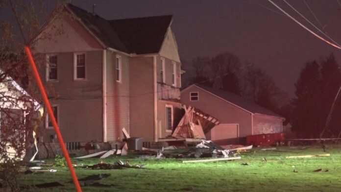
Northeast Ohio saw a rough night when a line of strong storms moved through the area, bringing strong winds, lots of rain, and lots of weather warnings from the authorities. The storm system, which started to move across the area late Wednesday night, caused alerts to be issued about strong thunderstorms, especially in Ashtabula and Lake Counties, and several more watches and advisories were also given around the Cleveland-Akron-Canton region.
Wind Gusts and Power Disruptions
Winds that were faster than 60 miles per hour were seen in many counties, which led to power lines and trees coming down. First responders were busy all night, working on things like clogged streets and small damage to homes, like broken fences, messed-up roofs, and things thrown about by the storm.
Utility companies said that many thousands of people lost power, and crews went out right away to fix the problems. As of Thursday morning, work was still happening to restore power in several counties, especially in areas by lakes where crews had a harder time reaching because of the flooding.
Also read : Philadelphia Weather Alert: Floods, Delays & Postponed Game
Heavy Rain and Flash Flooding
The storm system also caused 1 to 2 inches of rain for the area in a short amount of time, which flooded the usual drainage areas and led to some local spots where the water suddenly gathered quickly. Urban places like Cleveland and Akron had roads shut down for a while as standing water got in the way. Officials told people to stay off roads with flooding and keep checking news and updates for any new information about the roads.
Emergency shelters popped up in some areas to help people who were affected by flooding or storms, and the Red Cross stepped in to help with recovery.
Storm Path and Timeline
As the line of storms marched northward from the southwest, meteorologists noticed it getting stronger as it got closer to Lake Erie. During the evening of August 1, the strongest cells affected Ashtabula, Lake, Geauga, and Cuyahoga Counties, but additional ones launched a fresh attack around 3 a.m., endangering many communities for hours to come.
The NWS issued many Severe Thunderstorm Warnings and advisories during the night. Images from Doppler radar showed that some storm cells possessed strong wind flow and rotation, yet as of Thursday morning, no touchdowns were confirmed.
Also read : Indiana Storm Alert: Severe Weather Expected Thursday
Officials Urge Continued Caution
While the main part of the storm system is behind us, forecasters advise that there may be more sporadic showers later because the conditions are not yet calm. People living in the area should put away objects outdoors, keep alert to the weather, and let the emergency offices know if they notice any damage.
Thursday morning, Governor DeWine expressed thanks to the teams that responded quickly and promised help for the affected areas. He noted that Ohio residents are tough, and all the necessary help will be provided for communities to recover and do so safely.


