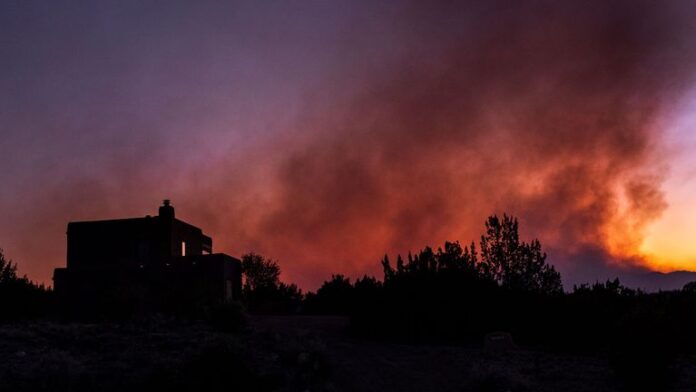
A combination of high winds, low humidity, and dry fuels has placed New Mexico at an elevated fire weather threat today. The National Weather Service has issued red flag warnings for quick wildfire growth in numerous areas of Texas. The same kind of weather conditions are also forecast in the surrounding areas of log, Colorado, and Texas, and the warnings are also issued in those places.
Most critical are strong wind gusts with sustained velocities of 50 to 70 mph, and near-critically low humidity values between 7 and 15%. These combine to produce a situation that allows it to be extremely easy for wildfires to initiate and quickly spread, a risky and potentially extremely expensive situation.
Severe Winds and Their Effects
As forecasted by meteorologists, the winds are to be from the west at 30 to 40 mph, with gusts up to 65 to 70 mph in some locations. There is also a possibility of the strongest gusts to happen during the afternoon and evening hours, mostly over central and eastern New Mexico.
It is recommended that those living and traveling within the dust storm area should expect dust storms that reduce visibility on highways and rural roads. It is also possible to have power blackouts because of strong gusts that could bring down power lines. Some damage can occur to homes, trees, and vehicles as a result of the force of the wind.
Also read: Amarillo Faces Extreme Fire Risk as Strong Winds Hit Texas
Low Humidity and Drought Conditions
The extremely low humidity is one of the major causes of the fire risk. There are numerous places where vegetation and dry fuels are extremely flammable, and levels have fallen below 15%, whereas they were once around 30%. In the absence of moisture in the air, which is what typically suppresses any naturally possible fires, firefighters are already confronted with a challenging task at the beginning.
Affected Areas and Emergency Warnings
Currently, the swath including Albuquerque, Santa Fe, the Southern Rio Grande Valley, and the Capitan and Sacramento mountains is under red flag warnings. Southern and eastern New Mexico are also reporting fire weather watches, which are other areas where conditions are appropriate for active fire development.
New Mexico, Texas, and Colorado, too, are under fire alerts. El Paso and Hudspeth counties of far west Texas can expect to experience wind gusts up to 50 mph, while eastern Colorado is likely to experience up to 60 mph. Fire conditions are also worsening; these areas are asked to be cautious.
Precautionary Measures and Safety Recommendations
Citizens are told to take active steps to prevent fire as well as shield themselves from dangerous circumstances. Campfire open flames and barbecues are strongly frowned upon. Also, people shouldn’t be doing anything that produces sparks, for example, welding or using power tools outside.
Where area travel is combined with dusty conditions, exercise extreme care when driving and be ready to lose visibility at any moment. If a wildfire does approach, follow officials if they instruct you to evacuate right away, and you should have an emergency plan in case the wildfire does ignite.
Since hazardous fire weather is expected to persist throughout the week, it is crucial that everybody remains updated with the situation and adheres to emergency notifications while striving to mitigate fire hazards.. Critical in determining whether the region suffers large-scale wildfires or a disaster over the next few days?


