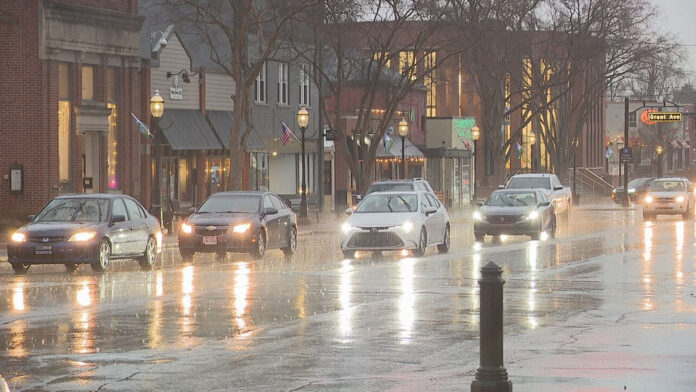
With the entry of the weekend in Columbus, Ohio, the citizens are getting ready to enjoy (or endure) a few days of constant rain and thunderstorms. Over Columbus as well as adjacent regions like Cincinnati and Wilmington, the National Weather Service has posted predictions of several rounds of wet weather. The longer stretch of unstable weather is likely to continue into next week and could produce some disruption in plans over the weekend, along with some worry about localized flooding.
A Stalled Frontal Boundary Brings Continuous Rain
This extended rainy weather is mainly due to an upper-level low-pressure system in association with a stationary frontal boundary, which has been positioned over the upper Ohio Valley. This weather configuration is not letting storm systems pass rapidly through the area, and moisture is just steadily flowing into central Ohio. This is why Columbus and other cities are having showers and thunderstorms repeatedly during the day and night.
The National Weather Service released an Area Forecast Discussion, which states that this pattern may continue until the beginning of next week. The forecasters stress that though it might not be raining all the time, the chances of daily showers and storms are great. These scattered showers might also cause flash flooding, particularly in the low-lying areas where the accumulation of heavy rainfall might cause a flash flood.
Temperature and Humidity Remain High
In spite of the continuous rains, the weather forecast indicates that it will be very warm and sticky in Columbus this weekend. The hot temperatures are predicted to soar to around mid-80s, with maximum temperatures of about 85 o F on Friday and about 87 o F on weekdays. Warm weather combined with a high level of humidity will make the life of residents unpleasant, even without the active precipitation of rain.
These moist conditions in the atmosphere participate in the formation of thunderstorms, some of which could bring short spells of heavy rainfall, lightning, and gusty winds. While severe weather is not widely expected, the frequent showers could still cause minor hazards for motorists and outdoor activities.
Localized Flooding a Growing Concern
The possible flooding is one of the main worries about this kind of weather pattern, of continuous rainfall. In the case of several rounds of showers passing over an area in a short period of time, the ground may become saturated, which raises the possibility of water pooling on roadways, fields, and urban drainage systems. The National Weather Service has cautioned residents to be more alert, particularly in flood-prone regions.
Motorists are cautioned to drive carefully and not to drive through flooded roads or even through shallow water, as it can be treacherous. The city authorities also keep an eye on the drainage systems so that they can contain the amount of rain that is likely to fall in the next few days. In case of the development of heavier storms, there might be short-term flash flood warnings.
Impact on Weekend Activities
The timing of this prolonged rainy season is especially daunting for the prospects of people intending to hold outdoor events and gatherings in Columbus. Weekend outings, sports events, and festivals can be disrupted or even called off in view of the probability of wet weather. Although forecasters are not predicting a complete washout, rain is an everyday possibility that could spoil plans.
It can also slow down local businesses that are dependent on outdoor customers, including farmers markets, golf courses, and outdoor restaurants. It is recommended that residents have an umbrella ready and monitor local forecasts regularly since conditions often change quickly.
Rainfall Pattern Expected to Continue
Meteorologists anticipate that the unsettled pattern may linger into the coming week, with rain chances continuing through next Thursday. The slow-moving nature of the upper-level low means that Columbus and surrounding areas may not see a significant break from the wet weather for several days. By mid-week, forecasters hope the system will finally move eastward, allowing drier air to return to the region.


